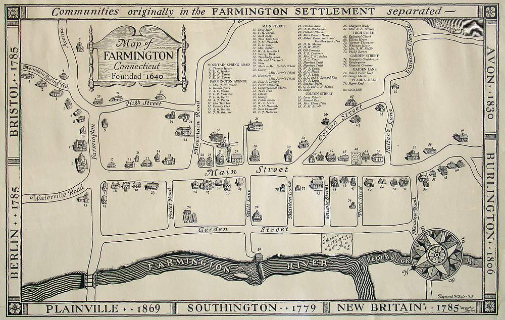
(Connecticut) Map of Farmington Connecticut Founded 1640
A handsome historical map for the city done in a simple black and white showing the primitive grid of the town. All of its early buildings are shown, all eighty are sketched, numbered and a key identifies each location. A surrounding border names the “Communities originally in the Farmington Settlement separated-” and lists seven (“Berlin 1785”, “Bristol 1785”, “Avon 1830”...).
Condition is good with some marginal loss and a repaired lower corner. Image size is 15.25 x 23.5 .