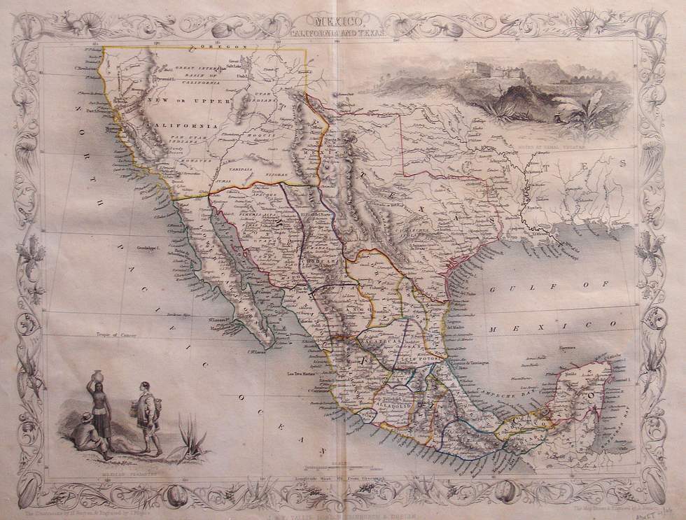
Mexico, California and Texas
This is the very scarce and desirable Tallis map of Mexico and the Southwest. Texas is shown with its old republic boundaries extending to the Rio Grande and with the panhandle extending north into todays Colorado. West of Texas is "New or Upper California" sparse detail and plenty of notations for native tribes and the key rivers. It is reached by the "Great Caravan Route" on the location of the Old Spanish Trail. Mexico is shown divided into its states. There are two vignettes characteristic of Tallis-Ruins at Uxmal, Yucatan, and Mexican Peasantry. The entire map is surrounded by a decorative border. The map is one of the most desirable of the Tallis maps
Condition is very good, with original outline hand color. Image size 10.25 x 13 (inches)