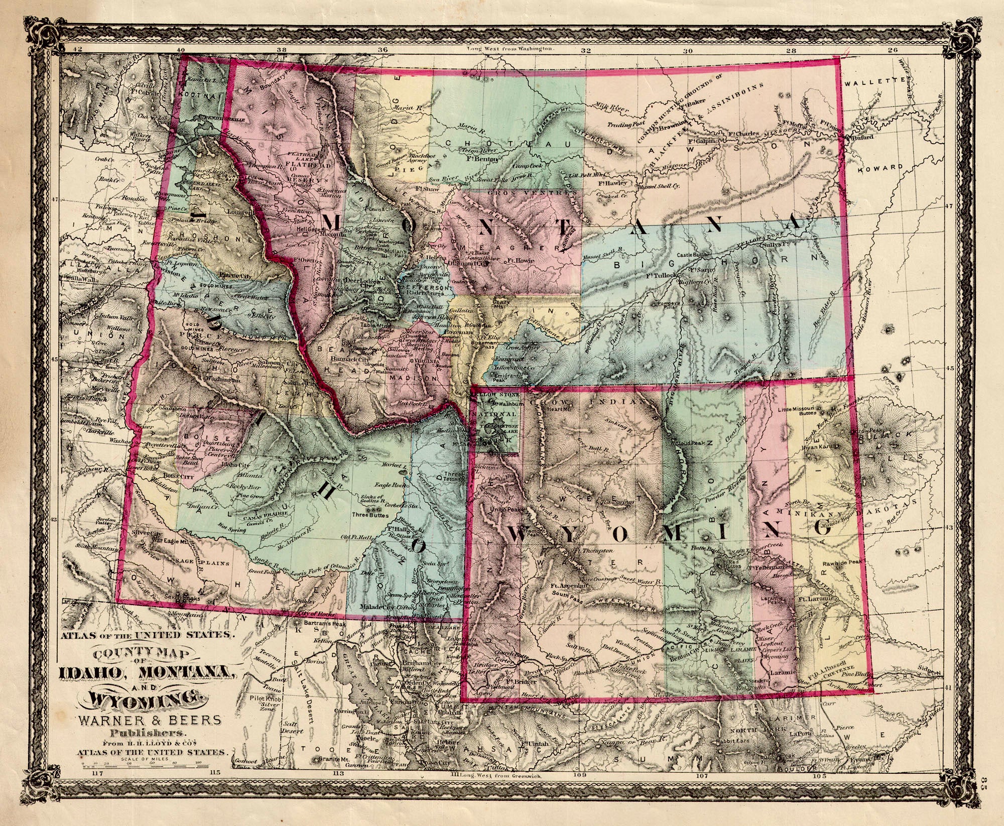
(MT., ID., WY.) County Map of Idaho, Montana and Wyoming, Warner & Beers, 1876 Here the territories of the northern Rockies at the time of the nation's centennial. Shows the growth along the Union Pacific R.R. line in Wyoming, here still a five county territory. While mining in the mountains of Montana has driven settlement. In its eastern plains vast counties are shared with Indian lands (Gros Ventre, Blackfeet & Assiniboins) . Idaho shows towns and forts as well as the major terrain and drainages. Condition is good with some light marginal staining on the left that just reaches into the decorative border. Image size is approximately 13.25 x 16.25 (inches)