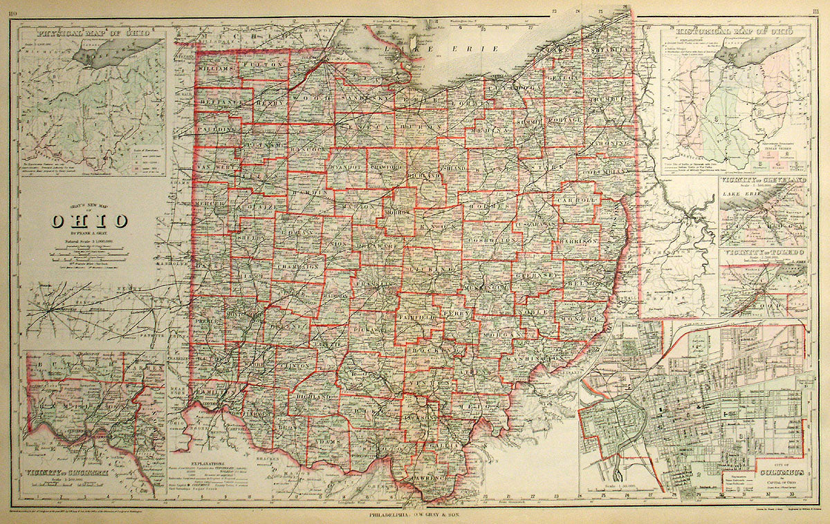
Gray's New Map of Ohio
An outstanding map of the state from the late 19th century that doesn't miss much. With a large overview of the entire state that is hand colored down to the township level, it includes the towns, counties, rivers, and railroads. Surrounding the large map is a series of insets, from thematic looks at the historical locations of Indian tribes to the state's physical character, to several insets for the state's major cities.
Condition is very good. Image size is 16.5 x 26.5 (inches).