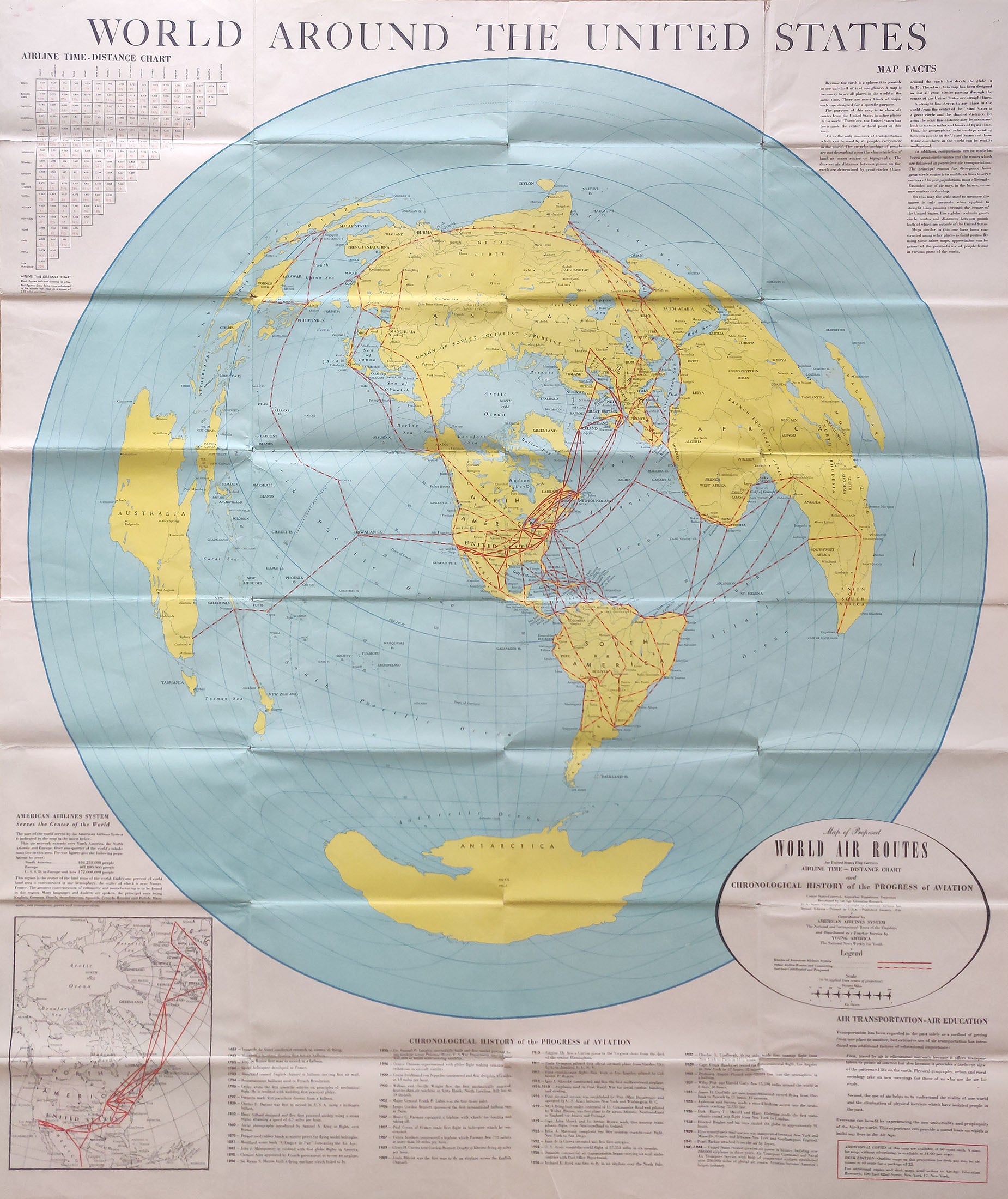
(World - Aviation) World Around The United States, American Airlines, c. 1945 At the bottom of this large wall map is a "Chronological History of the Progress of Aviation" starting with da Vinci in 1483, through Cayley in 1796, up through Wilbur and Orville right, to U.S. in 1941 - 1944 as aviation becomes one of its largest industries. This simple timeline dramatizes a world on a new style of projection that was now connected by easier air travel, with America at its center. A smaller map in the lower left shows how American Airlines "Serves the Center of the World", with air routes across the U.S. to Iceland and into Europe. A great, and uncommon map to illustrate the reassessment that the Air Age brought to the time, as proximity and connection could be calculated by air for the first time. Condition is very good with some minor corner fold separations, and minor scuffs and tears. Image size is approximately 48 x 40.5 (inches)