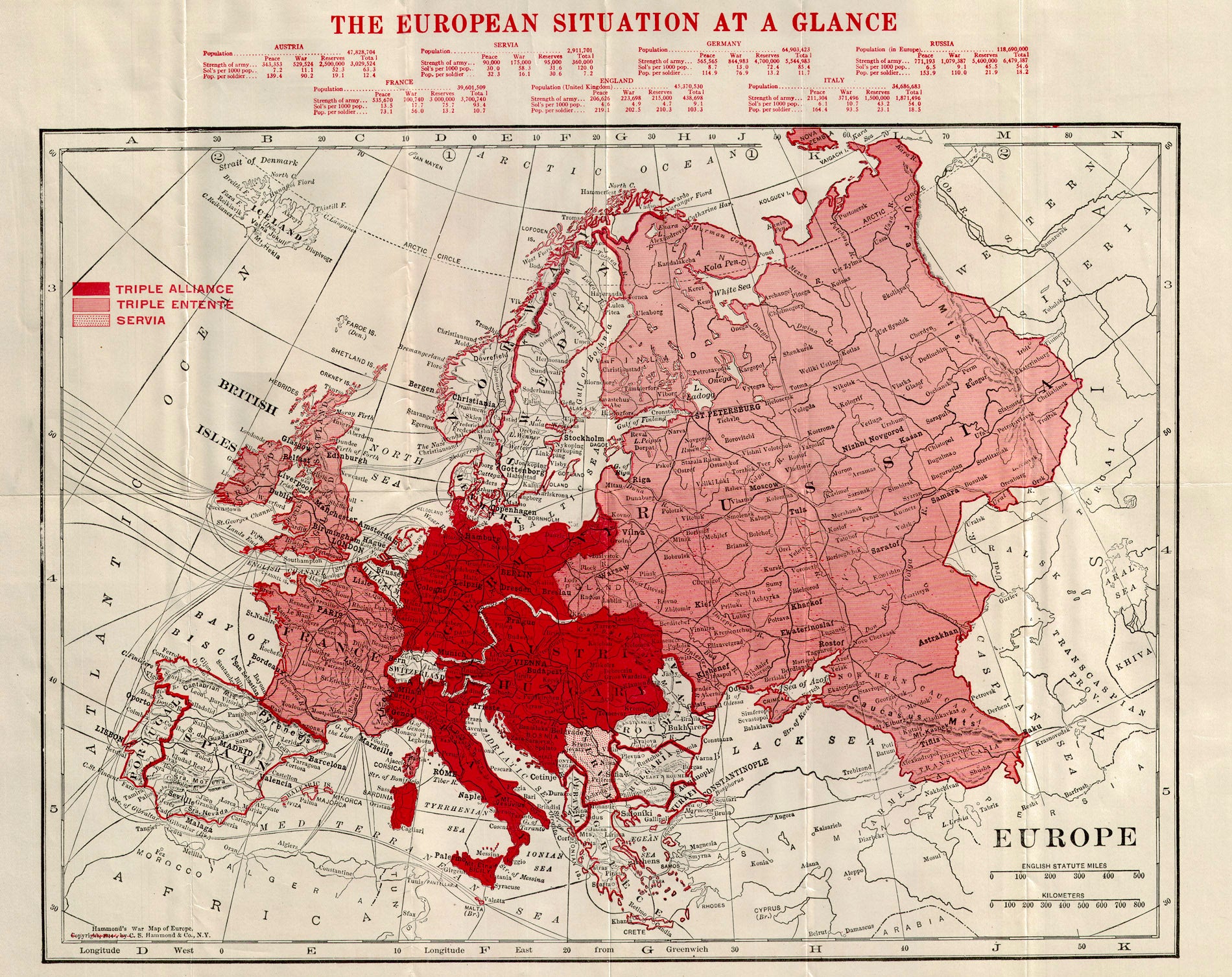
(WWI - Europe) Hammond's War Map Of Europe Showing all Countries Involved in Great Conflict of European Powers, C. S. Hammond, 1914 A folding map for the continuing convulsions of war in Europe that would now culminate in a great war here shown in three parts, the "Triple Alliance", the "Triple Entente", and "Servia". Statistics at the top of the map show national populations, size of their standing armies, and more. A rare reference to give Americans a sense of "The European Situation At A Glance", years before America would enter into the conflict. Condition is very good. Image size is approximately 13.75 x 16.5 (inches)